
Halfmoon Neighbors by Parcel
The public record for Halfmoon neighbors is a parcel exercise. The Saratoga County map viewer shows parcel geometry and map context. PROS adds the assessment record, owner name, mailing address, SBL or tax-map number, parcel class, values, and other property information. SearchIQS can then supply a recorded deed trail. Each source answers a different question, so keep the results in separate columns instead of turning them into a claimed household list.
| Source | What it shows about a block | Access |
|---|---|---|
| Saratoga County Map Viewer | Parcel geometry, frontage, road context, and the adjoining polygons | Public map browse |
| PROS/GAR Pros | SBL, titled owner, mailing address, assessment, parcel class, and property context | Public county property record |
| Halfmoon BAS tax search | Tax bill, owner, property address, tax map, and collection year | Public web search |
| SearchIQS deed index | Recorded parties, legal description, date, and document reference | Free account or clerk counter |
| Election-district maps | Street-to-district context, not a voter roster | County Board of Elections map resource |
| Community directory | Public civic and organization contacts, not member addresses | Town source and organization contact |
One parcel can have several recorded owners, while one owner can hold several parcels. A nearby polygon can also be a school, church, fire district, utility tract, vacant land, or a subdivision common area. Parcel class and map position should be checked before describing any parcel as a neighbor household.
Map Halfmoon Neighbors Carefully
Use the Saratoga County Map Viewer to locate or zoom to one verified parcel. The documented safe method is map browse: click the target polygon, record its SBL and owner-link information, then pan at the same scale and click each adjoining polygon. The research did not confirm a live buffer, radius, export, or select-by-polygon control, so a page should not promise an automatic “all neighbors” result.
- Search for or zoom to the target address and inspect the parcel polygon, not just the street label.
- Write down the SBL, situs address, postal city and ZIP, legal municipality, and any displayed owner link.
- Pan to each adjoining polygon and repeat the same fields, noting road frontage, rear boundaries, common areas, and waterways.
- Open PROS/GAR Pros for each SBL or address to confirm the assessment record and parcel class.
- Use SearchIQS or the county clerk counter only when a recorded ownership history is needed for a specific parcel.
This yields adjacent titled parcels, not proof of everyone who lives around the address. For a complete named-street records chain, use the Halfmoon by-street directory rather than stretching a block review beyond its evidence.
Halfmoon Neighbor Parcel Worksheet
A repeatable worksheet reduces common map mistakes. Keep the source and date beside every value, because parcel geometry, district boundaries, addresses, and ownership records can change. The SBL is the most useful bridge between map, assessment data, and a deed. If a polygon has no clear street address, use the SBL in PROS and compare the legal description rather than forcing a person-name match.
| Map position and frontage | Confirms that the parcel actually touches the target boundary. |
|---|---|
| SBL or tax-map number | Connects the map polygon to PROS, the roll, and deed research. |
| Situs and postal label | Prevents a mailing city from being mistaken for the legal town. |
| Titled owner | Identifies the recorded owner only, not every occupant. |
| Mailing address | A correspondence clue, not evidence of residence at the parcel. |
| Parcel class and district | Helps separate homes from public, agricultural, utility, or common parcels. |
| Deed reference | Provides a document route for a historic owner chain. |
If two polygons share one street number, treat them as separate parcels until the roll or deed explains their relationship. When a map and assessment record disagree, the assessor and county real-property office are the proper confirmation route.
Note: Retain owner party roles exactly as recorded and do not convert a legal ownership record into a household claim.
Halfmoon Neighbors and Postal Labels
Halfmoon records use four ZIP routes: 12065, 12118, 12151, and 12188. The postal labels can be Clifton Park, Mechanicville, Round Lake, or Waterford even though the legal municipality is Halfmoon. A town address, a situs address, and an owner mailing address can therefore carry different place names. This is normal local geography, not evidence that the parcel lies outside the town.
Use the property location and SBL to identify the parcel. Preserve the postal city and ZIP exactly as the roll shows them. The 2014 assessment-roll example for Tabor Road shows a Round Lake 12151 address while the record sits in the Halfmoon assessment context. The town’s history also explains older labels: Waterford separated in 1816, Clifton Park in 1828, and Mechanicville in 1910.
Halfmoon Neighbor Voter Limits
New York’s individual voter lookup cannot be used as a public block browser. The official tool requires a specific person’s last name, first name, date of birth, county, and address information. It is intended for registration, poll-site, and ballot-tracker status in that authenticated search context. The absence of a result is not proof that a person is not registered, and a voter result is not proof of household membership or ballot choice.
A full voter file is request-only and restricted to an elections purpose under Election Law § 3-103(5). Saratoga County’s election-district maps are the appropriate public route for connecting a street to current district boundaries. A current map should not be used to reconstruct an earlier district after redistricting. For historical work, the county historian’s voter-list holdings cover 1912 to 1975 and require a focused request or appointment.
The Saratoga County Board of Elections source provides the local election contact and poll-site resource context.
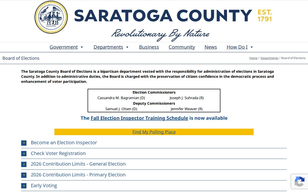
The Board of Elections image supports a district and service lookup, not a list of people who live on a block.
Note: District maps show where an address falls for elections, not who is registered at nearby addresses.
Halfmoon Neighbor Community Contacts
The town’s community layer can explain a block’s civic setting without identifying private members. The official community directory names the Halfmoon Celebrations Association, Rotary clubs, American Legion Post 1450, VFW Post 1498, churches, emergency corps, fire departments, schools, and the Chamber of Southern Saratoga County. These organizations are public contact points for local history, events, reunions, and general questions. They do not publish or establish member-by-address rosters.
| Community contact layer | Useful question | Limit |
|---|---|---|
| Halfmoon Celebrations Association | Community event and local-history context | Do not infer nearby membership |
| Rotary clubs | General civic contact or historical program lead | Not a resident directory |
| American Legion Post 1450 and VFW Post 1498 | Memorial history, reunion, or organization contact | Membership rolls are not established as public |
| Churches, fire departments, and emergency corps | Public service and community context | Building proximity does not establish affiliation |
| Schools and Chamber | Public program or organizational contact | Use official contact channels only |
The Halfmoon community directory is the appropriate starting point for that public organization layer. The town’s official home and services directory is another current civic starting point when an organization listing changes.

The town source helps locate public service and community contacts while keeping private household information outside the search.
Compare Halfmoon Neighbor Sources
Official records show their scope and custodian. A county parcel source can identify a recorded owner and parcel attributes. A deed index can document a legal instrument. A community directory can list public organizations. Commercial neighbor-search tools are a different category: they may merge public-record feeds, address histories, marketing data, and third-party data, often with stale or mixed identity information. They have no official standing for a block question.
| Official source | Commercial category | Best practice |
|---|---|---|
| Names the keeper, scope, and access rule | May combine sources with unclear update dates | Verify any claim at the listed custodian |
| Separates parcel owner from location | May merge names or former addresses | Use SBL, legal description, and date to test a match |
| Shows documented limits and protected records | May imply a complete household result | Do not treat it as a complete neighbor list |
The useful result is modest and specific: identify adjacent parcels, recorded owners, and public community context, then verify each fact through the source that owns it.
Halfmoon Neighbor History Clues
For an older block, pair today’s parcel geometry with the county’s 1856 Geil map, 1866 Beers Atlas, school files, cemetery compilations, and old directory street sections. The modern road may use a different postal heading or may sit near an old hamlet boundary. Canal and river terms, bridge references, road discontinuances, and former postal city names can be useful search words when a modern address produces no historical result.
The 1853 fire destroyed most Halfmoon town records, but two of the earliest minute books survived. That loss explains gaps in local series. It does not mean every historical question has no source. The Town Clerk, historical society, library, county historian, county clerk, and Brookside each keep different pieces of the local record trail.
Note: Mark the map date beside every historical observation because parcel lines and road labels change independently.
Halfmoon Neighbor Privacy Limits
Private utility and delivery records are not public block data. A parcel owner may not live at the parcel, and people who live there may not appear in a public owner record. New York’s Address Confidentiality Program protects actual addresses through a substitute mailing address under Executive Law § 108. Confidential voter registration under Election Law § 5-508 is separately unavailable for public inspection, and sealed court, adoption, vital, and DMV records have their own limits.
Lawful use. Use Halfmoon neighbor records for personal, lawful property, family-history, civic, or safety questions. Never use an address or record trail to stalk, harass, intimidate, or harm anyone.
If an official record seems wrong, contact the custodian rather than publishing a guess. The assessor handles assessment data, the county clerk handles recorded documents, and the Board of Elections handles voter information and changes.